
Spatial Fire Management Planning
What is a spatial fire management plan?
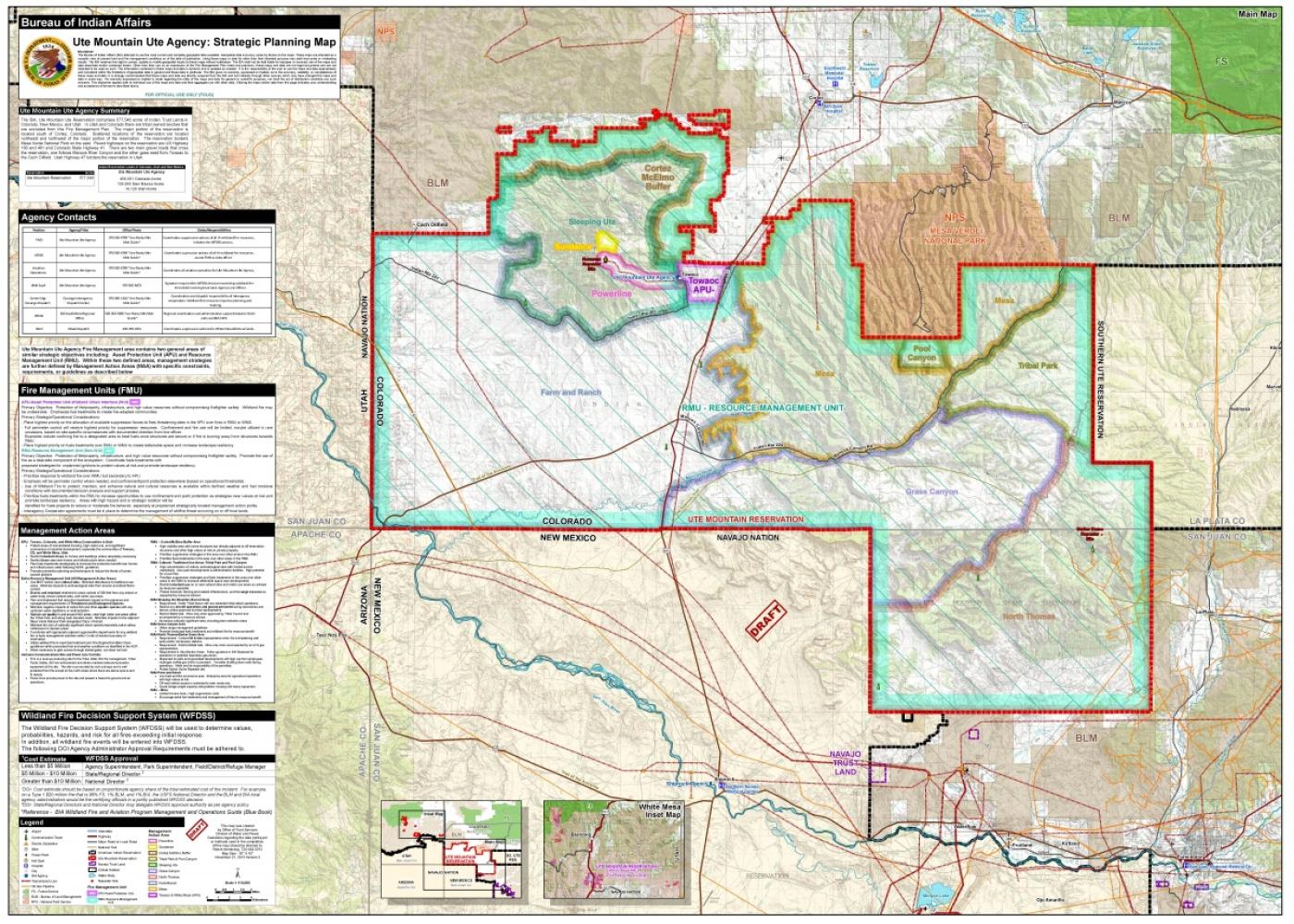
A spatial fire management plan is a collection of succinct text, maps, tables and other elements that can be quickly referenced to provide intuitive access to critical fire management information. It displays key strategic and operational guidance information in a geospatial and graphical format called a mapsheet.
As managers complete fuels projects or when wildfires occur that would alter the plan, mapsheets can be easily updated to keep information real-time and relevant to users.
Does the Bureau of Indian Affairs implement spatial fire management plans?
Bureau of Indian Affairs units do not currently require spatial fire management plans.
However, pilot projects are underway in most federal land management agencies to assess the process and value of mapsheets. Currently, the Southwest and Western BIA Regions (Southwest and Western) have completed spatial fire management plans. There are two additional projects underway in two more regions. All projects are voluntary efforts by individual field units.
The goal of these pilot projects is to develop a process to improve wildland fire management plans so that relevant information is more easily accessible, while minimizing unnecessary information in the spatial narrative.
The Bureau of Indian Affairs template is consistent with and meets the intent of the 2009 Wildland Fire Management Plan template used by all Department of Interior agencies.