
Hours of Operation: 8:00 A.M. – 5:00 P.M. CST
Russell Felicia
Acting Superintendent
Mailing Address:
Bureau of Indian Affairs
190 Oyate Circle
Lower Brule, South Dakota 57548
Physical Address:
Bureau of Indian Affairs
190 Oyate Circle
Lower Brule, South Dakota 57548
Telephone: (605) 550-1932
Telefax: (605) 473-5016
Tribe Served:
Lower Brule Sioux Tribe
Boyd Gourneau, Chairman
187 Oyate Circle
Lower Brule, South Dakota 57548
Telephone: (605) 473-5561
Telefax: (605) 473-5606
Trust Land Base: 156,917 acres
Estimated Tribal Enrollment: 3,410 members
The Lower Brule Agency is located at Lower Brule, South Dakota, and services the Lower Brule Sioux Tribe and Reservation. The reservation covers 404 square miles in Lyman and Stanley counties in central South Dakota, bounded on the northeast and east by the Missouri River, which was closed by the Big Bend Dam in 1963. On the east and north side of the reservoir, Lake Sharpe, is the Crow Creek Reservation. The Lower Brule Reservation population is 1,664 and tribal membership is 3,410. The Agency headquarters is located in the Lower Brule Tribal Administration building, newly constructed in 2001, staffed with 15 permanent employees. The Lower Brule Sioux Tribe is the largest employer on the reservation, operating many BIA and IHS programs, the Golden Buffalo Casino & Motel, Tribal Farm, propane plant, popcorn processing plant, a construction company, and hunting enterprise.
ON RESERVATION:
- Trust Acres
- Tribally owned 140,463.47 acres
- Individually owned 16,454.00 acres
Total trust 156,917.47 acres
- Fee/Deeded Acres (taxable)
- Tribally owned 7,860.63 acres
- Individually owned 880.00 acres
- Non-Indian owned (approx.) 61,003.00 acres
Total fee 69,743.63 acres
OFF RESERVATION
- Tribally owned in Fee status (taxable) 25,790.43 acres
- Tribally owned in Trust status 3,524.34 acres
Total Off reservation 29,314.77 acres - 100 Farm/Pasture leases - 88,253.37 acres – 4 non-Indian F/P leases
- 8,000 acres under 56 center pivot irrigation systems operated by Lower Brule Tribal Farms
- 25 Range Unit Operators - 84,402.77 acres - All Indian operators
- An Integrated Resource Management Plan (IRMP) is in the planning stages and will provide future guidance to the Tribal Council.
LAW ENFORCEMENT
The Office of Justice Services provides direct service law enforcement services to the Lower Brule Sioux Tribe. Services entail providing uniform patrol officers that enforce federal and tribal codes, and a criminal investigation unit that investigates major crimes.
The Bureau of Indian Affairs has released a community briefing video from a July 22, 2025, in-custody death in Lower Brule, South Dakota. The community briefing video is intended to help the members of the community gain a better understanding of what occurred. This incident is still under investigation. A word of caution: this video contains graphic content. Viewer discretion is advised.
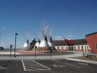
Lower Brule Tribal and Agency Building
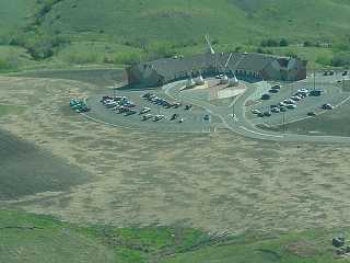
Lower Brule Sioux Tribal and Agency Building

Smokey the Bear in front of a Fire Truck